
From Site To
Survey-Ready Data
Drone, LiDAR and 3D survey services for architecture, engineering and construction teams.
Accurate data Safer access Minimal disruption
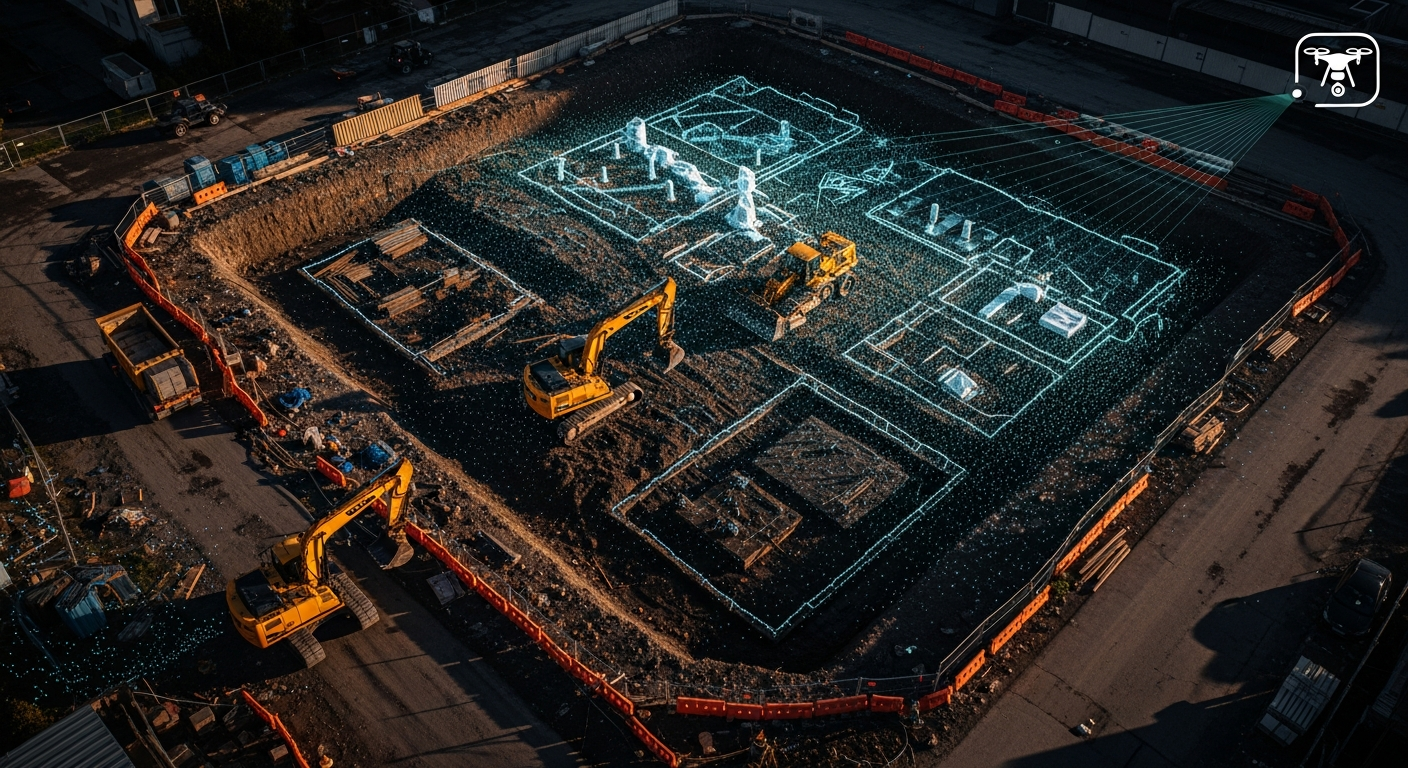
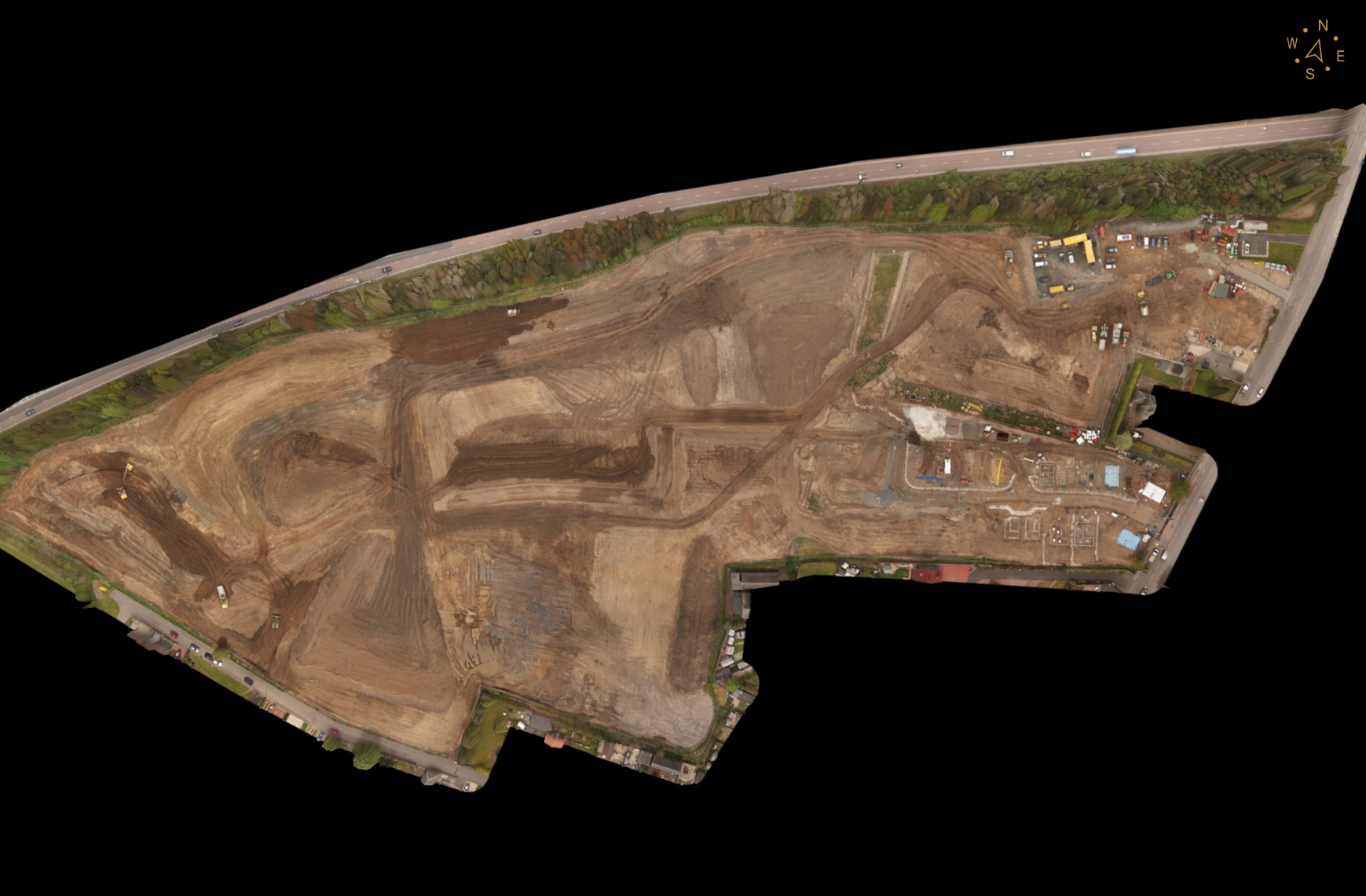
Site Capture
High resolution aerial imagery and LiDAR
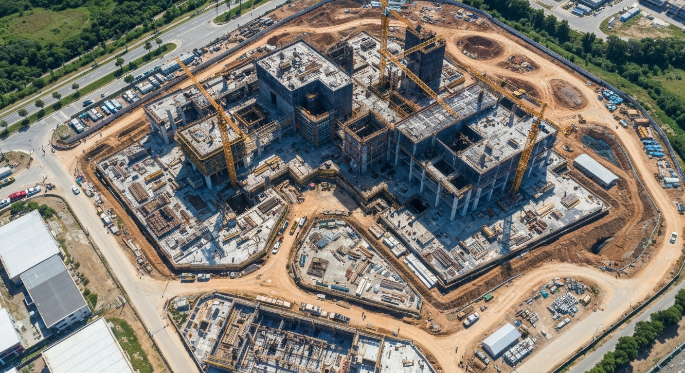
Reality Data
Point clouds, 3D models and measurements
Survey Outputs
CAD, 3D models, topo maps and reports
From capture to clear deliverables
Site Capture
High resolution aerial imagery and LiDAR captured safely and efficiently across active sites and hard-to-reach areas.
Reality Data
Dense point clouds, 3D models and accurate measurements processed into usable site intelligence.
Survey Outputs
CAD, 3D models, topo maps and inspection reports delivered clearly for your project team.
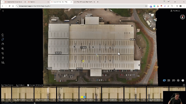
From Raw Data to Actionable Insight
Drag the slider to see how we transform raw site captures into clear, precise 3D models and point clouds.
Need survey-ready data
for your next project?
Speak to DroneWorks about drone, LiDAR and 3D survey support for your site, asset or development.
Learn More
Watch our latest deep dives into drone surveying, LiDAR processing, and AEC deliverables.

100 Days of Earthworks: Every Change Tracked With Drone Surveys

Excavators Throwing Off Your Volume Calculations #construction #dronedata

See How Drones Replace Days of Manual Inventory Work #construction #drone #timelapse #stockpiles

See Your Forestry and Powerline Sites Like Never Before with drone lidar surveys

This Tiny Drone Just Changed Building Inspections Forever #dji #shorts #blockmanagement
Survey and inspection services
for AEC teams
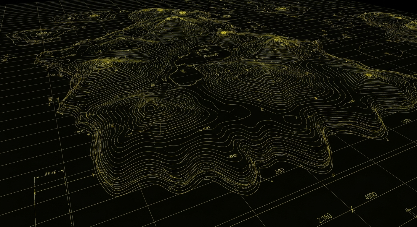
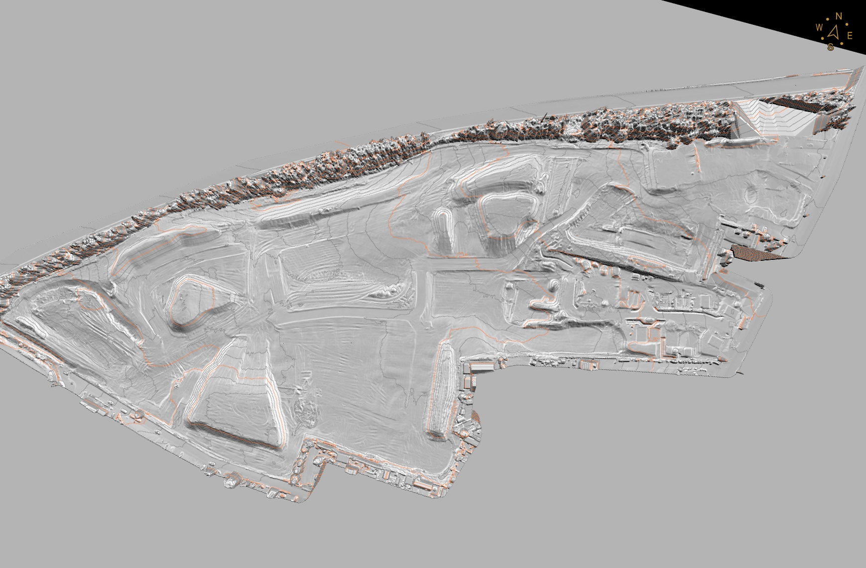
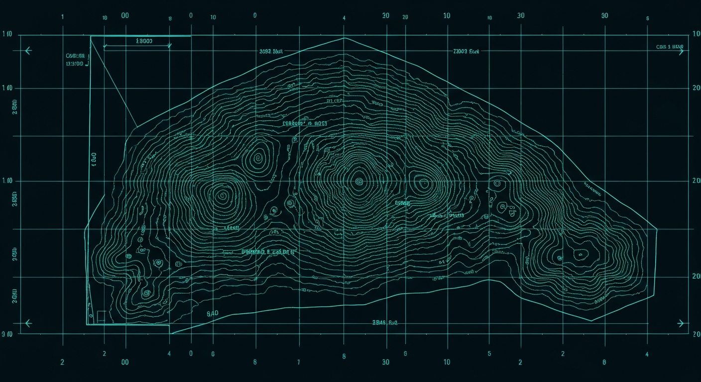
Topographic Surveys
Accurate land surveys for planning, design and construction.
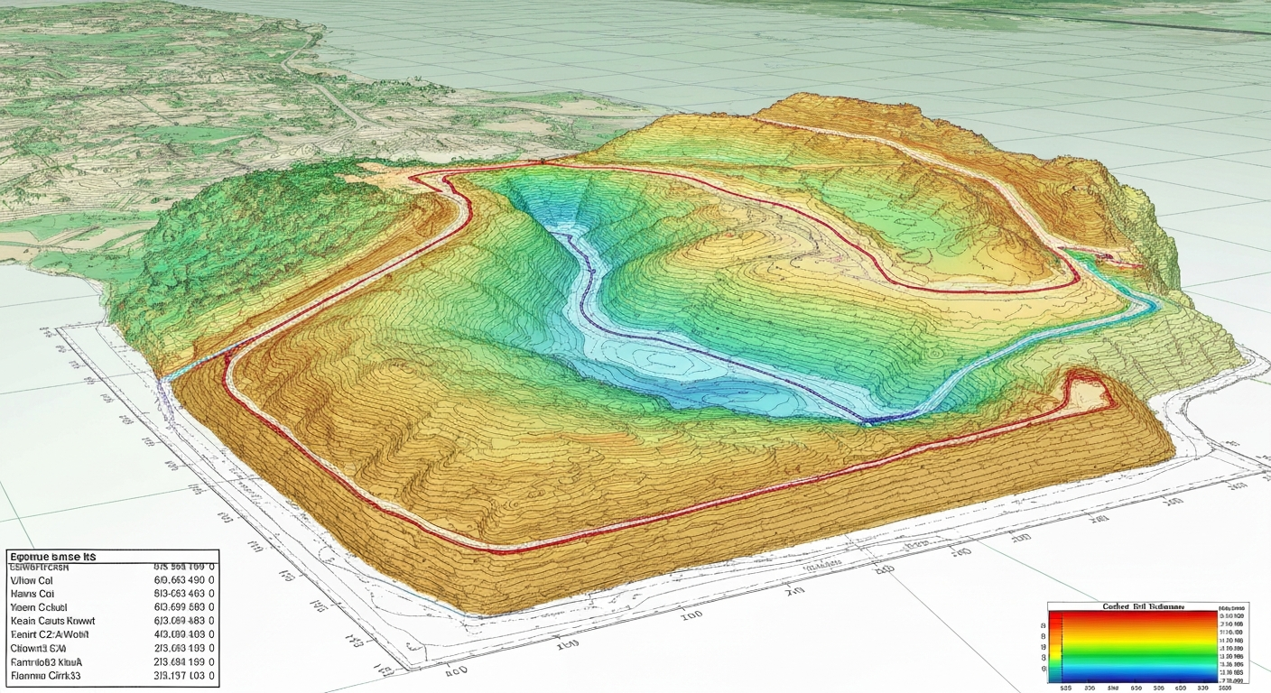
LiDAR Mapping
High density point clouds for sites, structures and terrain.
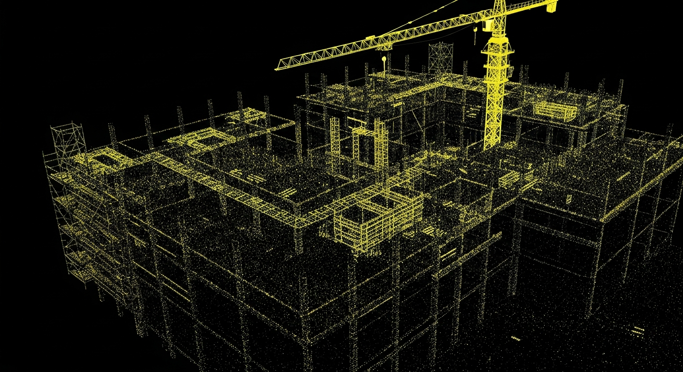
3D Models / Point Clouds
Detailed 3D deliverables for design, coordination and analysis.
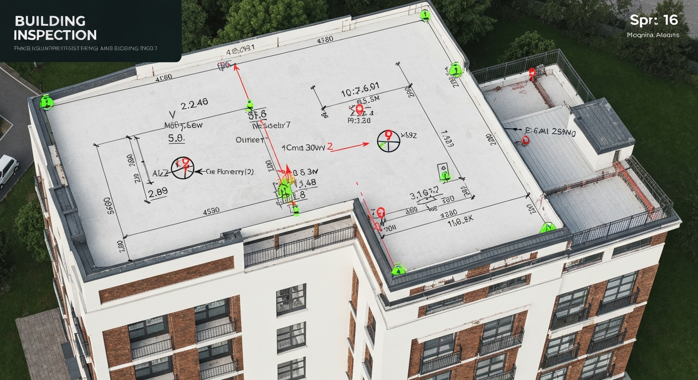
Roof & Asset Inspections
Safe, efficient inspections of roofs and assets, without disruption.
Better data,
fewer site headaches
We understand that you don't just need drone photos. You need reliable, survey-grade data that integrates directly into your existing workflows.
Accurate Data
Survey-ready outputs that help teams make confident decisions.
Safer Access
Reduce the need for working at height, scaffolding or unnecessary site exposure.
Minimal Disruption
Capture site data quickly without slowing down the project.
Precision LiDAR &
Topographic Surveys
Centimetre-accurate terrain and site data captured rapidly. We deliver survey-grade intelligence for complex landscapes and structures.
High-Density Point Clouds
Capture millions of data points for unparalleled site detail.
CAD-Ready Topo Plans
Seamlessly integrate 2D and 3D deliverables into your design software.
Hard-to-Reach Areas
Map dense vegetation, steep slopes, and hazardous terrain safely.
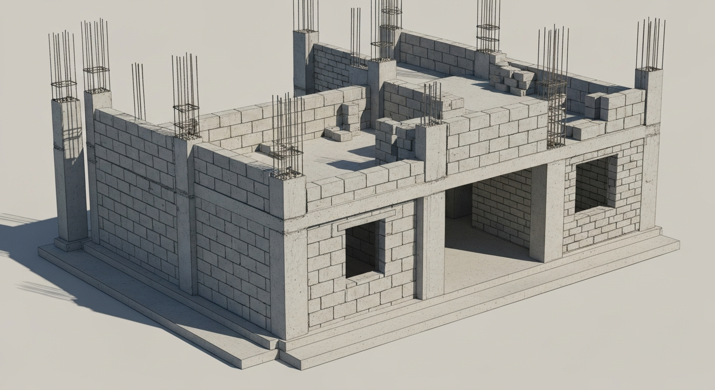
Construction Progress &
Earthworks Tracking
Keep your project on track with regular aerial site intelligence, volume calculations, and as-built verification.
Cut/Fill Volume Calculations
Accurate stockpile measurements and earthmoving data.
As-Built vs Design
Overlay 3D site captures onto CAD/BIM models to verify progress.
Visual Progress Reporting
High-resolution orthomosaics to keep stakeholders informed.
Safe Property &
Asset Inspections
Detailed visual and thermal data for building condition assessments, minimizing the need for scaffolding or rope access.
High-Res Imagery
Capture intricate details on roofs, facades, and hard-to-reach assets.
Defect Identification
Spot structural issues, water ingress, and wear with annotated reports.
Reduced Risk
Keep your team safely on the ground during initial assessments.
Interactive 3D Solutions
Navigate and inspect your assets remotely with immersive 3D digital twins.
Built for real
project demands
See what you actually receive
Orthomosaic / Aerial Image
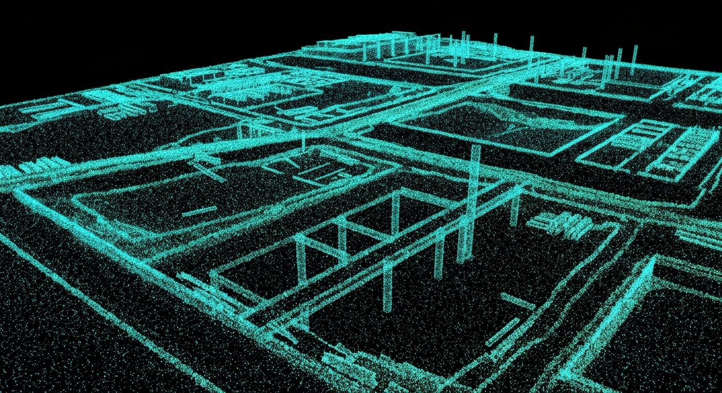
LiDAR Point Cloud
2D CAD Topographic Plan
Earthworks Monitoring
3D Model / Mesh
Annotated Inspection Report
Experienced. Qualified. Safe.
Experienced
DroneWorks brings practical site experience across property, construction, industrial and infrastructure projects.
Qualified
Commercial drone operations delivered by trained, competent and insured operators.
Safety Focused
Data capture planned around safe operations, site constraints and minimal disruption.
Industry Accreditations
& Certifications


Client Success Stories
How much does a
drone survey cost?
Read our comprehensive breakdown of drone surveying costs, deliverables, and the factors that influence pricing for AEC projects.
Need survey-ready data
for your next project?
Speak to DroneWorks about drone, LiDAR and 3D survey support for your site, asset or development.